The hike up Mount Teneriffe is not an easy one - in my opinion, it's the most strenuous summit one can find for 4 points. There are 2 main routes to the summit; the new trail / road walk, which is about 13+ miles round trip, or, the more direct route; Kamikaze Falls then up Serendepity Ridge. I've done both routes multiple times - I prefer the much shorter Kamikaze Falls / Serendepity Ridge as it's only about 7.5 miles round trip. As this route is about half the length of the new trail / road walk, it's obviously steeper - really steep!
Blogs
Tibbetts Mountain, Washington May 2020
Tibbetts Mountain near the small town of Pashastin in Central Washington is one of my favorite early season SOTA destinations. Great views from the summit of the Enchantments and Stuart Ranges.
There are 3 ways to reach the summit; hike the trail (about 3 miles each way), hike the road (about 4 miles each way) or drive the rough narrow forest service road to within a half mile of the summit, then hike the last 1/2 mile with a few hundred feet of elevation gain. Google maps directions will take you to the summit, or within the last 1/2 mile of the summit.
Table Mountain, OR | May 2020
Table Mountain is an easy, near drive to, summit with one of the best views in my opinion. You are looking down at Howard Prairie and Hyatt lake, with a fabulous view Mt. Mcloughlin on your left and Mt. Shasta on your right. Since this is near my home area it is a great place for us to look at all the summits we have done and want to do. See what still has snow, what is open.
Dinah-Mo Peak, OR | May 2020
Adrian, Patrick and I headed up for some backpacking/activating on Friday. We drove to South Breitenbush Trailhead with the intent of camping 2 miles in then attempting a first activation of Dinah-Mo Peak and heading back down the next day. Well, with what I thought was an hour of slack time, we encountered first some downed trees on NF46 (Clackamas River Hwy - Breitenbush River Road) and then were stopped by downed trees a mile and a half from the trailhead. No big deal, we have a little time, right?
Chuckanut Mountain, WA | May 2020
For some reason, Chuckanut Mountain was not on the top of my list for a 2 point summit. Two reasons were probably the long hike for two points, and uncertainty about going off trail to the summit. After not hiking for 6 weeks due to Covid-19 lock-downs, this was a great hike to enjoy being back on a trail. While a bit longer hike, the elevation gain is gradual and the final off-trail summit push is also gradual and easy to traverse.
Directions:
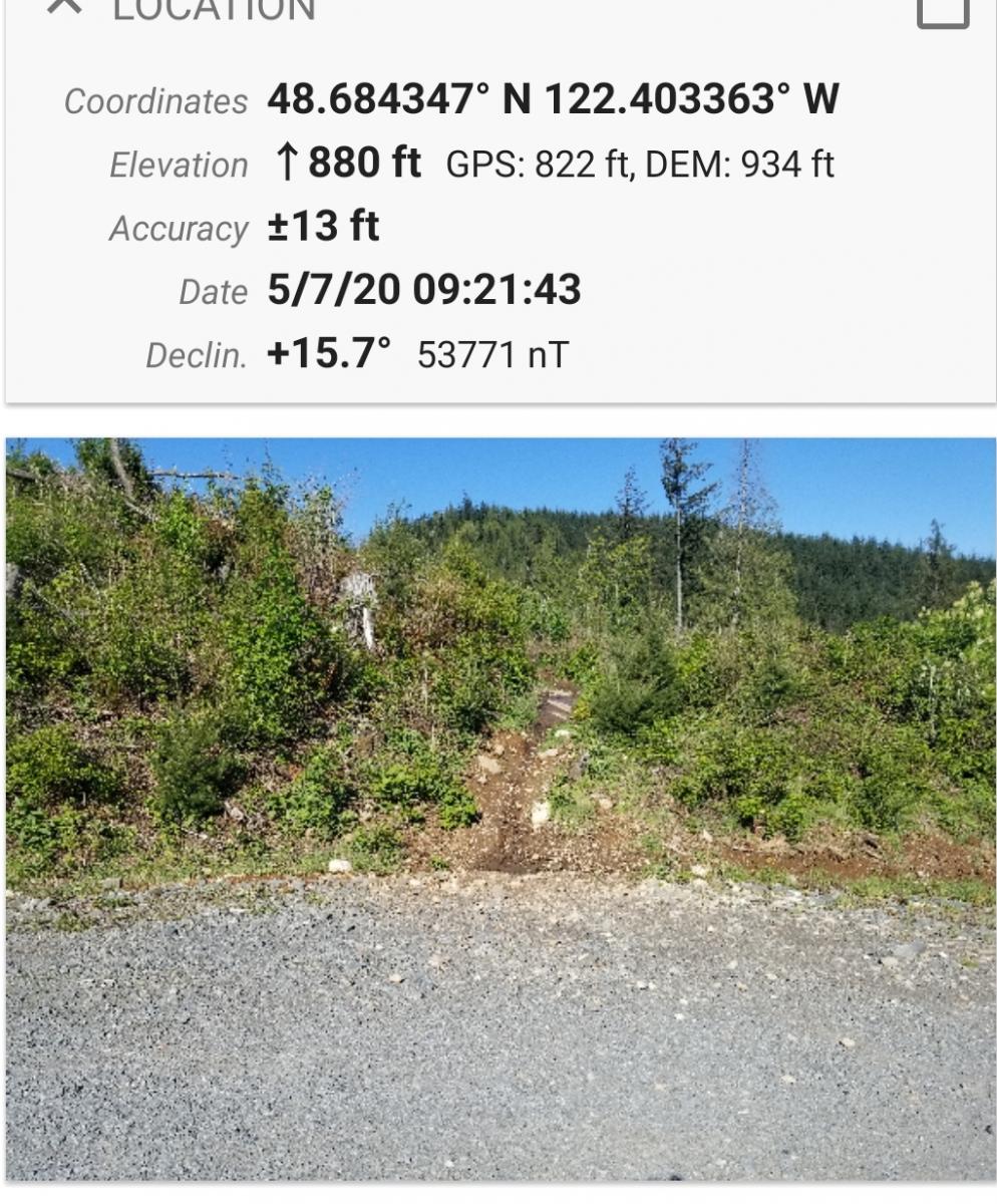
Magnetic Hill near Bellingham WA
This is an easy hike half on a good road and half by trail. The area is also used by mountain bikes. There is limited parking at the gate at location 48.688594 N, 122.403296 W, although few use this trail system. Follow the well maintained road .6 miles until the place on the right side of the road where the trail begins. See Picture.:

Strawberry Mountain, OR | July 2017
Here's one of Oregon's most approachable ten-point summits.
Fuller Mountain, WA | May 2020
Another nice little peak in the Snoqualmie Forest, located in the Campbell Global logging property. The "trail" to the summit has been re-done recently, making it far easier to find than my last trip there 2 years ago - Thanks to whoever did this! This trip is best done as "bike-n-hike". Easy 2 mile bike ride along loggin roads to the "trailhead".
Sardine Mountain, OR | Oct 2019
Sardine Mountain is a short and steep trail of only about a third of a mile, but gaining about 500 feet. This is essentially a social trail that heads straight up the ridge that will disappear into the shrub in places. There are skittery rocks near the top requiring some focus to find a suitable path upwards. From the Willamette Valley, take Highway 22 east until just before the Breitenbush River bridge takes you into Detroit. You'll turn left here onto French Creek Road and go about 4.1 miles until the pavement ends and keep left onto Road 2223.
Cinnamon Butte, OR | July 2017
This is a fun activation with an manned fire lookout (active during summer only of course) a few miles north of Crater Lake National Park. If the lookout is occupied and the gate is open, it would be a drive-up. If the gate is locked, it's a mere 1.7 miles of road walking OW and 900 feet gain. Along Highway 138 and about 11 miles north of Highway 209 that enters Crater Lake National Park, find Cinnamon Butte LO Road (FS 4793).


