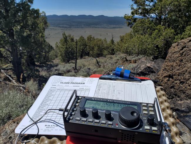
This was literally my first activation. I've been thinking about SOTA on and off for 7+ years now. Ray & Max posted a trip that they took to this same summit maybe 6 years ago, but I took a different route. Looking at the maps, and reading the rules, the route they took is along the OHV roads which are closed to vehicle traffic. The entirety of Horse Ridge is closed to motorized vehicle travel. Instead, I parked along the south edge of the Horse Ridge area along Ford road, along a spot where I could easily pull off and not be in the road itself.
The hike itself was a pretty straight forward cross-country trek, about 1.5 miles each way and about 850' elevation gain. There are a few barbed wire fences to cross, some down and historic, some more modern and maintained. None presented a real obstical though. Use of Avenza maps and the Horse Ridge Recreation map provided by the BLM is highly encouraged. The northbound OHV trail and BLM roads technically go through private property to my understanding, though the BLM might have right of way. The road going up into golden basin is technically off-limits to vehicles, though while I was at the summit, I still saw a motorcyclist. Otherwise, not a single person on the summit.
My trip up was basically a straight north ascent and then following the ridgeline WNW to the summit. There are a few false summits, take a GPS (or avenza maps) and you'll get there.
This weekend was near perfect weather. Not too cold, not too hot, a slight breeze to take the edge off the sweat of hiking after 2 months in quarantine.
My setup is a KX3 with a homemade 20m 2-radial vertical on a 25' fishing pole/mast. I will post a youtube video from the summit on this front, search my callsign on youtube, and you'll find my channel for an upload on that probably sometime next week.
In the end, 23 contacts, 1 summit-to-summit, and a great first time activation for me. I'm happy with how it went, and the worst thing I forgot was my hiking boots (so I just hiked in shoes instead).


