A short brushy hike will take you to this numbered summit near Ariel, Washington.
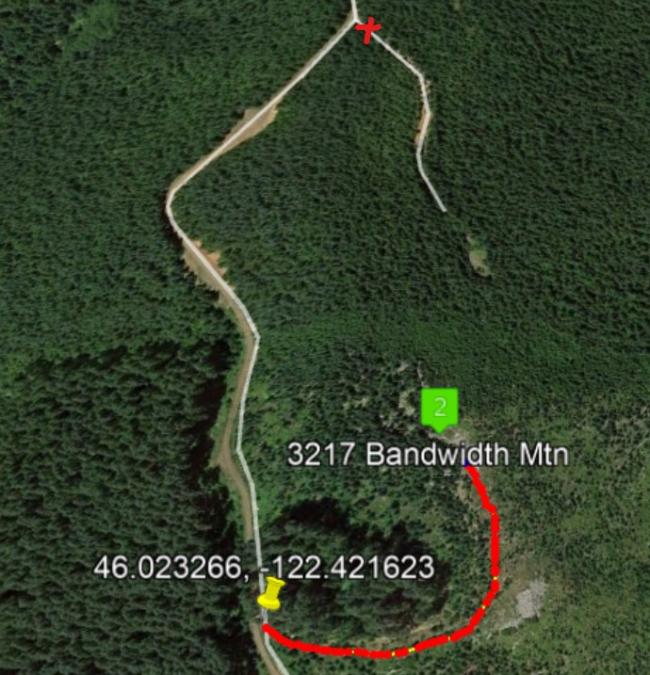
The gravel forest road route is Priusable all the way to the trailhead - although you'll be dodging a number of potholes. You'll circle all around the summit to come at it from the north. There is a brushy uphill bushwack included in the adventure. There is an alternative route through second growth marked with an X on the map below - that route isn't as pleasant.
Get to Woodland, Washington and head east on the Lewis River Highway - 503 . About 7.7 miles east of the wide spot that is Ariel, turn left off the Lewis River Highway to Rock Creek Road and go about 3.6 miles to a sharp right turn. Continue on about 1.5 miles to keep left at a fork. Continue about 1.5 miles to a wide intersection and a right turn onto a somewhat narrower road - on this road you'll go about 0.9 mile to a bermed road on the left. Find a place to park near 46.023266, -122.421623. On foot you travel a closed road for about 0.2 miles through brush to the summit. There you will find plenty of trees for your wire antennas.
A Garmin GPS took us to this spot navigating the forest roads - YMMV. We easily worked two stations in Portland on 2m FM but am not sure you can count on stations with good VHF reception to get your four contacts.
ViewVoting details
Peak 3217, WA | May 2021
Summit:
W7W/LC-112
Voice Cellular Coverage:
Don't know
Data Cellular Coverage:
Don't know
Cellular Provider:
N/A
APRS Coverage:
Don't know 

