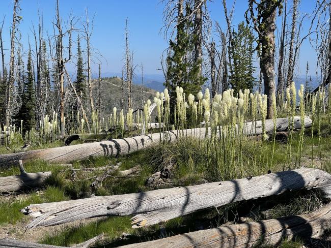
Devils Point is a mostly open snag-covered summit with excellent views of the surrounding Frank Church River of No Return Wilderness and the Hell’s Half Acre Lookout. Much of this area has experienced very large wildfires over the last several of decades and abundant snags exist. Operators should be aware of snag hazards when selecting your operating position and hiking especially on windy days.
Trail Miles: 3.0 Roundtrip
Elevation Gain: 700’ Loss: 200’
Water: None along the trail route. Water is available from Deep Creek.
Bear Spray: Recommended for all ID/MT summit hikes
Camping: Good flat area at the trailhead and a stock loading ramp.
Map: US Forest Service Bitterroot National Forest
Directions: South of Darby MT leave highway #93 and travel up the paved West Fork Bitterroot River Road for approximately 14 miles. Turn right, west onto the intermittently paved Nez Perce Fork Road. Travel up this road for approximately 16 miles to Nez Perce Pass. Nez Perce Pass is a large parking area with vault toilet, a helicopter landing area and three large interpretive signs. From the Pass continue downhill approximately 8.0 miles to FS #224, a left turn prior to leaving pavement and cross Deep Creek. This gravel road is suitable for pickup trucks and most SUVs. Travel up that road approximately 8 ¾ miles to the trail head. The trailhead is signed FS Trail #8. see photos.
Hikel up trail #8 approximately ¼ mile to a saddle. Here the well-used trail #8 heads east but look for a rock cairn and faint trail to the right heading southwest. This trail is FS#703 and takes you to FS trail #67. It does have small rock cairns on both ends, but no marking signs. Hike across this basin approximately another ¼ mile to trail #67. It is signed on a downed log, see photo. When you intersect trail #67 do look back to note your route back to the saddle and trailhead. Now you are on well defined trail #8 that drops elevation for ½ mile and then climbs another ½ mile to the summit of Devil's Point.


