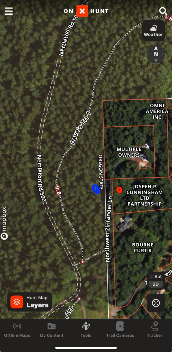
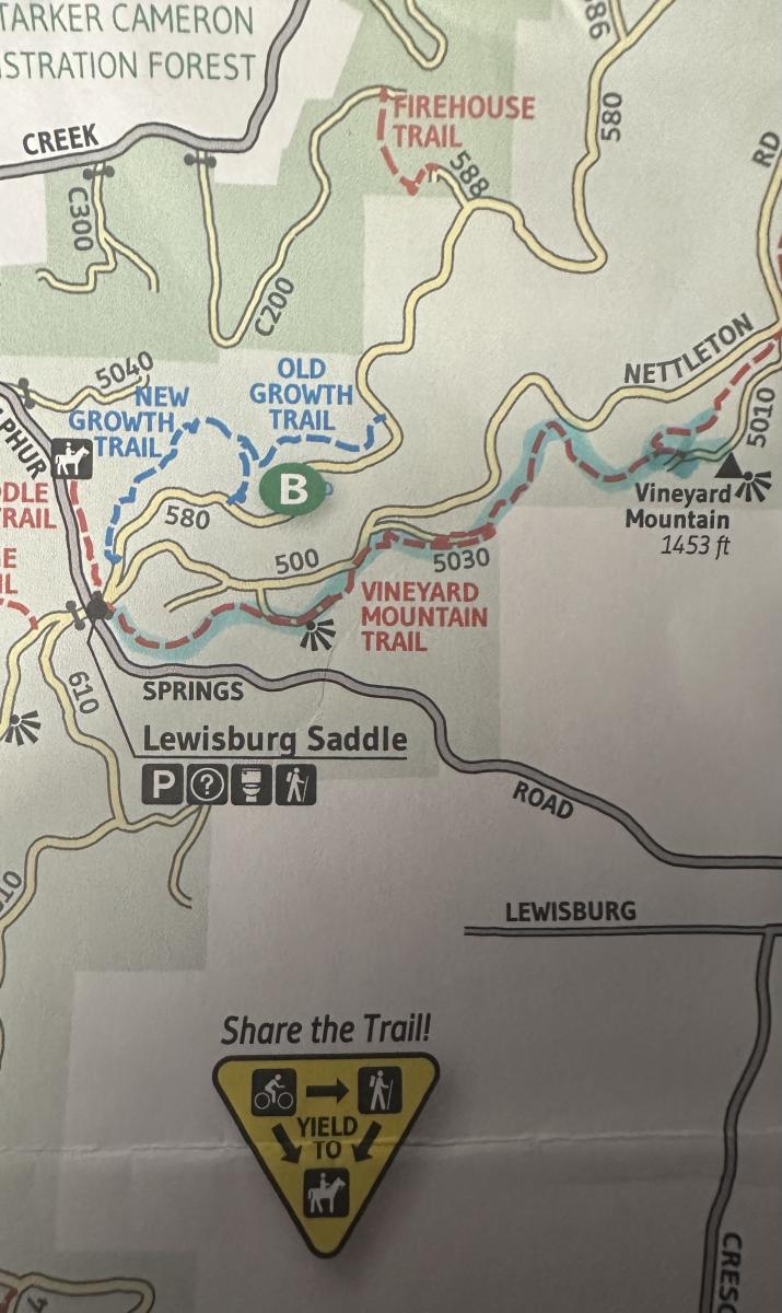
Start at the Lewisburg Saddle in the OSU research forest. Hike the Vineyard Mountain Trail shown on the maps provided at the trailhead or you can walk the Nettleton road. Trail was by far the better choice. while hiking you will pass mountain bikers on the way down as well as other hikers and this trip we came across some horseback riders. Roughly 2.5 miles to the summit. you can either go through the gate on the right side at the end of the trail and walk to the top past a private house. End of the road is a gate to the tower site. No trespassing signs are visible. So operating from the top is not possible. There is private property on the right that is not posted(shown in red on attached picture). Guess you could operate from there. We chose to operate on the left side of the road which is within the activation zone. As well as in the OSU Forest boundary. Alternatively, you can take the Dave’s trail and walk around the mountain and then walk off trail into activation zone.
2 meters was a bust as there was RF from the radio site. Worked 20 meters just fine. I'm sure you could drive to the site. But why would you with such a nice trail.