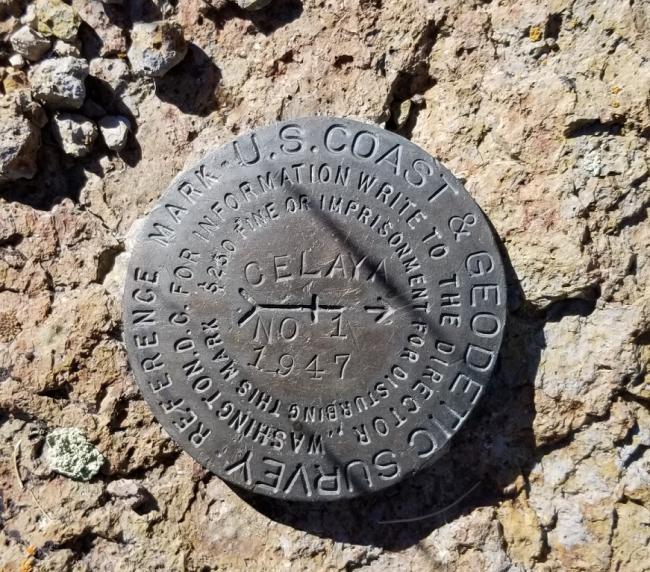
This was the first activation of Celaya Benchmark. The summit is very non-descript, extremely exposed but close to a drive-up activation. The last 2 miles is a lightly used overgrown road, but certainly comfortable in a small 4-wheel drive (Subaru Outback/Crosstrek). I would NOT recommend a Prius attempt this last section of road. If driving in a low clearance sedan, you could park at the intersection described below (42.02146, -114.94743) and hike the last 2 miles. The elevation gain is less than 400 feet to the summit.
There is a USGS marker at the summit but is appears to be slightly lower than the high point. Regardless, this is where I set up and activated. It was my first time deploying a sunshade that I jerry-rigged from a cheap Walmart tent rain fly. It worked like a charm. Activating on a mid-week morning was a risk, but I was able to work chasers on both 20 and 40 meters.
Directions: Head west from Hwy 93 onto Three Creek Road out of Rogerson, ID. This is also called Jarbidge Road. There are two ways to get to the approach, the first is to head south on Monument Springs Road (42.21270, -114.78683). This is where you leave the pavement and head south on a well graded dirt/gravel road for approximately 18.1 miles. Both Gaia and USGS maps do not accurately indicate the summit access road where you need to turn north. The actual intersection is located at 42.02146, -114.94743.
The second way to this intersection is a shorter dirt road (14 miles) but a longer drive overall if coming from Hwy 93. Continue on Three Creek Road/Jarbidge Road and turn east at 42.11494, -115.02895.
Coming from either direction you arrive at the intersection (42.02146, -114.94743) and head north. There is one cattle gate that you’ll need to move out of the way and put back once through. This is an easy 2-mile drive. I parked the JEEP at 42.04798, -114.93826 and walked the ¼-mile to the summit.


