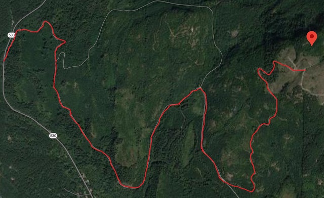
Had chatted with KA7GPP some time back about various different local SOTA summits to venture to and Ittome Hill was one of those. Was slated as a drive up with great views and decent activation. The XYL and I set off leveraging Google Maps and what we thought was going to be a quick venture up. However, Google maps steered us wrong. The image below shows the correct route up to the summit.
Google will get you to Illabot Creek Road off SR 530, however thats when the directions stop becoming helpful. Illabot Creek road is fine for 99% of the vehicles out on the road. It's gravel, but very well maintained. It isn't until you turn off and head up towards the summit that you need a 4x4 vehicle with some decent clearance. There appear to be several wash outs that have been fixed recently. Once you get towards the top near the activation zone it's a clear cut area with decent views of the valley.
I setup with my Jackite Mast with my Packtenna 20M Dipole and my Arrow 2m Yagi about 3/4 of the way up. Tried reaching out on 2m but after some time of hearing nothing back, I hung up the 2m and switched over to HF. Was able to make enough contacts to activate, however those 6 contacts over the hour were definitely a challenge.
Overall, it was a fun trip up there with the XYL and the weather proved to be nice.


