Access:
Rainier National Park pass required, $30 per vehicle for the day. Nisqually Entrace is closest to I-5 and reached via Elbe WA. There are a number of routes to Lane Peak depending on road closures. Stevens Pass road closes for winter (even in the hottest October ever recorded). Parking available at several points along Paradise Valley Rd. We parked at the closure which is near Ruby Falls. This leaves you with about 1 mi of road walk before descending toward Tatoosh Creek directly toward Lane from the North of the peak.
Route:
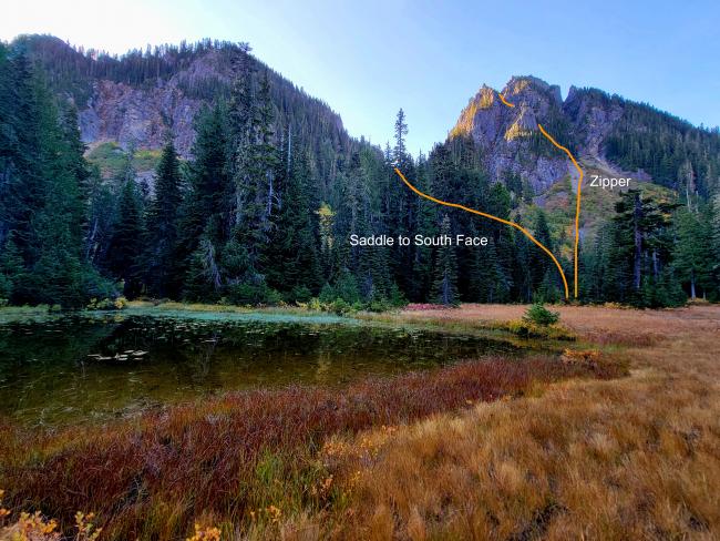
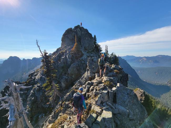
The route from the road is seasonal, but both involve descending from the road to the valley and Tatoosh Creek. Early summer may provide snow/ice passage from the valley floor to the peak, late summer is mostly or completely melted out. From the base of Lane, we climbed the scree toward the middle of three couloirs. This is known as the Zipper. This was a summer condition climb with zero snow and increibly loose rock. It is not a hike, it is a full day of rock climbing (4 class scramble to low 5 class rock) that requires comfort with exposure, avoiding rockfall, placing and using protection, belays and rappels. The couloir was a bowling alley with each member of our team freeing rocks that ranged from pebbles to watermelon sized. Clear, coordinated movement and communication is essential for safe group movement.
There is a more civilized route around the east of the peak to the south face and up to the summit. Neither route has a clear trail, and both require bushwhacking. The route is more visible in winter as vegetation is dormant or buried in snow.
Radio and cellular coverage:
The Paradise WW7CH repeater (146.78 103.5hz tone) is strong on the entire route although I got no response during the attempted activation. Calling on 146.58 and 146.52 was not successful although I was able to self-spot via my phone (and use data to respond to chasers via slack and text message). No cell coverage avilable until the upper portions of the peak. PDX and SEA/TAC are both blocked by peaks (Helens to the South and Rainier to the North) contributing to difficult VHF conditions.
There is ample space on the summit block and within the activation zone for antennas and comforatble radio operation.


