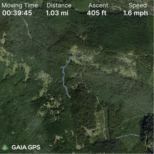
In my continuing series on easier/shorter approaches to summits, I found a back-side social trail to Barlow Ridge summit.
Originally I was just going to bushwack it (0.6 mile and 400' elevation gain) but upon arrival I discovered this path.
Directions are from Highway 35 at NF-3560. Turn onto NF-3560 and drive south until 45.273015, -121.649866 where there is a spur road leading west. I did not try to drive up that since it narrows and the usual vehicular paint warnings apply. There is space for 1 or 2 vehicles on the side of the road at the junction.
At the end is a dispersed camping spot and firering, bear to the right up a disused cat track and you will find the social trail that leads over to the Barlow Ridge trail and on up to the summit. I think this is used by hunters because we found salt blocks in the meadow.
I should mention that I did not follow that trail all the way to the BR trail because it starts to drop back down so I left at the ridge and bushwacked up wards from there. You eventually cross back over the BR trail anyway (around 45.26965, -121.65584) so it saves some effort and the bushwack is pretty much open with some branches fallen on the ground.
My son KK7HWY joined me for this adventure and we were able to work folks back into Vancouver and Portland on 2m with varying degrees of success.
A J-pole or other improved antenna is recommended. I then switched to 40/20m and worked another series of QSOs.


