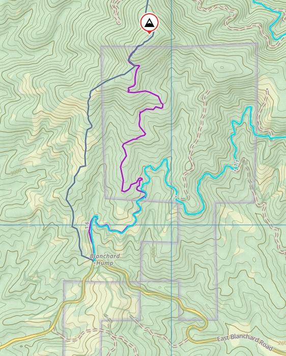
Just to add an alternate route if you don't have an Inland Empire Paper permit.
There is a gated access road that starts at the same Blanchard Hump parking area as previously mentioned.
Follow the road upwards which has quite a few switchbacks so the distance uphill is more like 2.75 miles OW.
The road is part of Hancock Timber IX and is posted for non-motorized access only. Partway up, the land ownership transitions to WA DNR for most of the rest of the way to the top.
Interestingly, there is a disabled viewing stand halfway up the valley road which has a ramp and side rails.
This morning I surprised a clutch of turkey chicks who were not expecting my arrival and this annoyed their mother.
It took me around 1hr and 45min to reach the summit. I followed the motorcycle track back down which goes onto IEP land. I have the requisite permit. The route down was more like 55min.
NOTE: there were a lot of ticks on the summit. Check yourself carefully.


