NC-128 is one of the "new" peaks added during the 2023 ARM update. It's on private Stimson land, but publicly accessible to walk-in during weekends and after 4pm on weekdays. The easiest access is drive-in/hike-in from the south via Turner Creek Rd past Barney Reservoir, but would also be accessible by long hike or bike via the north through the same roads as NC-066. If doing the drive/hike route, it's a 15 mile gravel road drive and a 1 mile gravel road hike to the summit. This is easily paired with Blind Cabin Ridge NC-031. It's also possible to get there from the west roads near NC-071, as another possible pairing.
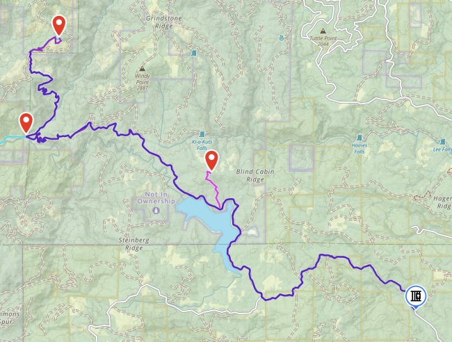
Routing (see map picture - GPX available on sotamaps/SOTLAS):
- Start from Yamhill to Pike Rd to Turner Creek Rd (other routes starting farther north will hit gates).
- Pass through the Weyerhaueser Turner Creek gate at (45.41287, -123.29614). This gate is open through most of the high season and fishing season, but can be closed at times, including when the IFPL level reaches IFPL3 (google for "Oregon IFPL map"). Check the page https://recreation.weyerhaeuser.com/ -> Our Programs -> Willamette Valley Access Information. This link/page is updated regularly with new information.
- At the gate, the road becomes gravel for the rest of the trip. It is dirty and has some potholes, but is driveable in a passenger car.
- From the gate, proceed 15 miles on the "main" road past Barney Reservoir. This route is the same as Blind Cabin Ridge:
- At 1.4 miles from the gate, stay left at the fork, staying on Turner Creek Rd
- At 4.8 miles, stay right at the fork, onto North Fork Trask Rd. This runs alongside the reservoir and through a couple more gates
- If you want to go to Blind Cabin Ridge, turn North at 8 miles (45.44447, -123.38008), otherwise keep going along North Fork Trask Rd.
- At 8.8 miles at the end of the reservoir, stay to the right as the road becomes North Fork Gales Creek Rd (although depending on your map, it might still call it N Fork Trask Rd)
- Continue to 15 miles from the original gate, and take a hard left/north up the reverse fork (45.46623, -123.46331), onto Shetky Rd
- Proceed on Shetky Rd for 3 miles to the Stimson gate at (45.49187, -123.46143), there is plenty of parking.
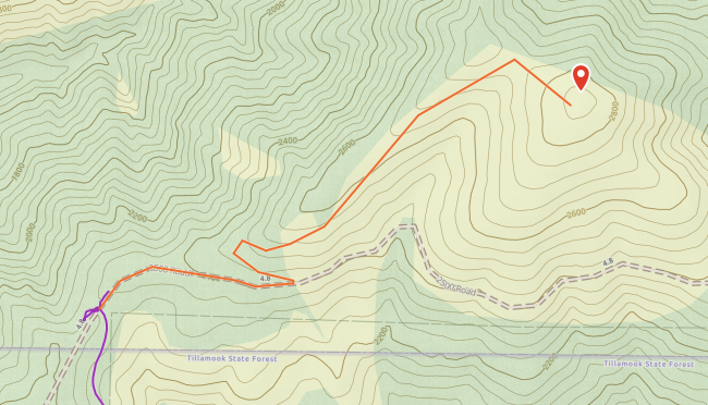
From the parking spot at the gate, the hike to the summit is about 1 mile and 500 ft elevation gain on a gravel road. The final ascent is directly up the side of the clearcut hill and easily traversible in boots or sneakers.
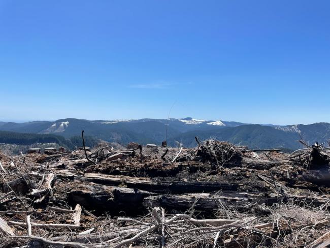
The summit is a wide open clearcut with plenty of slash piles and stumps to attach masts, but no tall trees to throw lines over. Multiple activators are easily accomodated. The views are nice.
It's also possible to use North Fork Trask Road to get to NC-071, so one could design a route that includes this peak and NC-071 in a day, rather than Blind Cabin Ridge.


