
Cowan Lookout is an abandoned fire lookout site that sits at 1,955' on top of a ridge that, at the other end, hosts an antenna site. Locally, the place is known as "Radar Hill." It is located in the hills that overlook the town of Naselle, WA, and the Naselle Valley, due west of the intersection of U.S. 101 and WA 4. You can drive to within a short distance of the activation zone, but the final 100' of ascent is a bushwhack.
This activation occurred on my trip to SeaPac in Seaside, Oregon on June 4th. I left home at noon on Thursday and headed for the coast. This was the first of two nearby activations I did on my way there.
The starting point is a gravel road that begins at 46.3913308, -123.8280845 (map) at about 24' MSL. The road is 3.1 miles SW of the U.S. 101 and WA 4. When you turn off the highway, the intersection branches in three directions, one of the roads is the entrance to the Naselle Youth Camp. A sign points you straight ahead toward Radar Hill.
From there you will follow a reasonably good gravel road for about 4 miles and 1,800 vertical feet. I recommend you print out a Google map of the roads in this area. Bing, Mapquest, OpenStreet Maps, ESRI and even USGS topo maps do not show all the roads. Here is what I did (click for larger image):
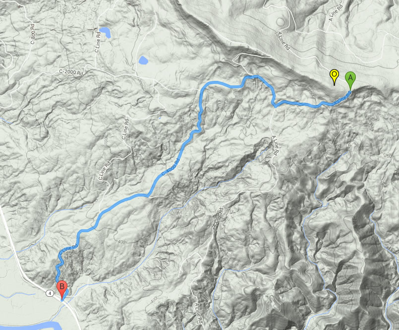
From the highway, follow the C-line for exactly one mile, and take the C-4000 branch to the right. At exactly three miles, you will come across a right turn that descends. This road does not show up on most maps, but is perfectly navigable. If you ignore the turn and continue on the main road, it will take you in short order up to the radio towers. The activation zone isn't there, but you can park, get out of your car and enjoy a spectacular view. Then turn around and head back down to the 3-mile intersection. That road will descend a couple hundred feet, ascend again, and take you around to the east end of the ridge.
There are a few spots to park on or near the former road to the summit.
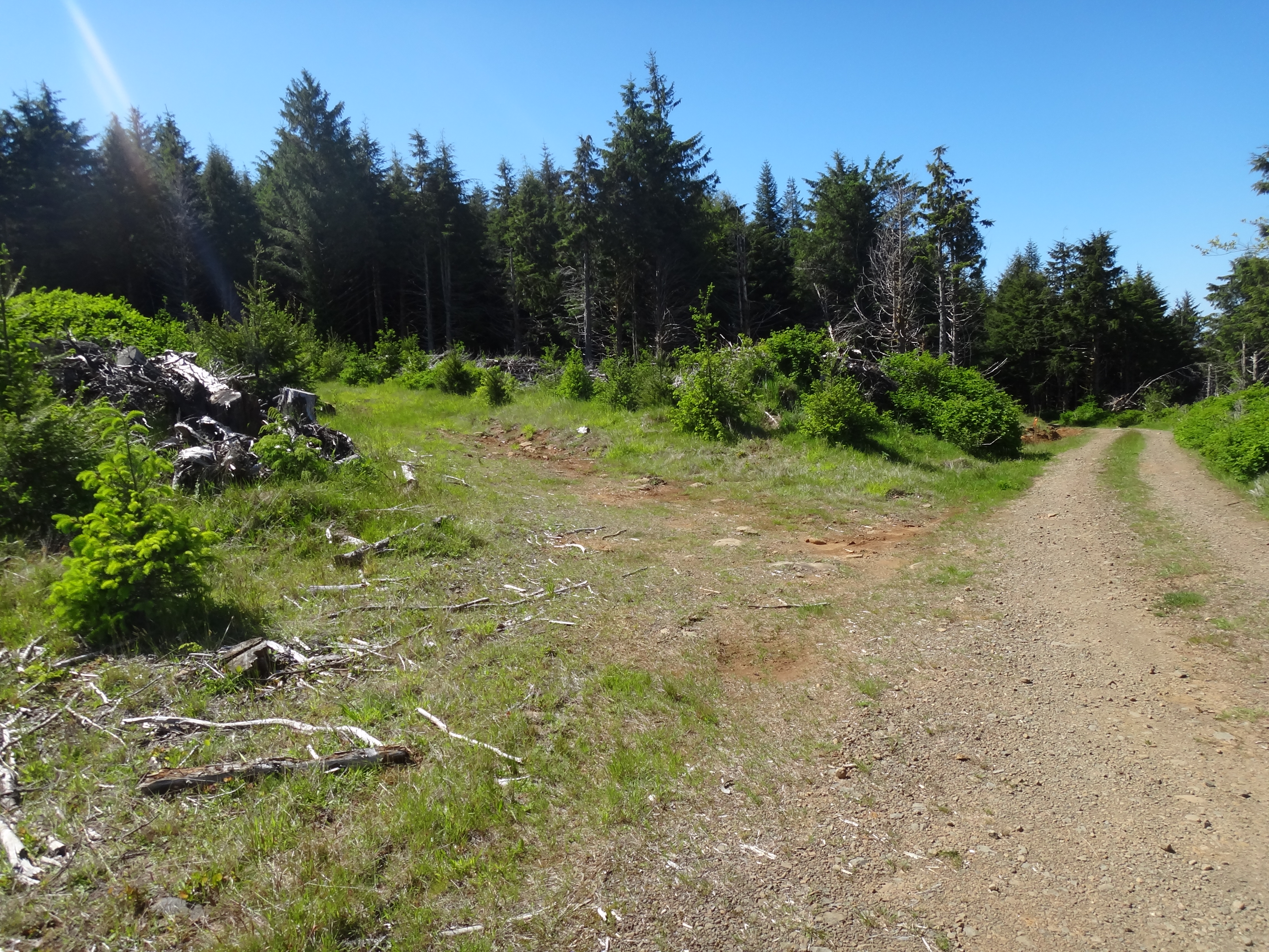
Head up this road on foot until it seems to dead-end into a jungle. Then the bushwhacking begins.
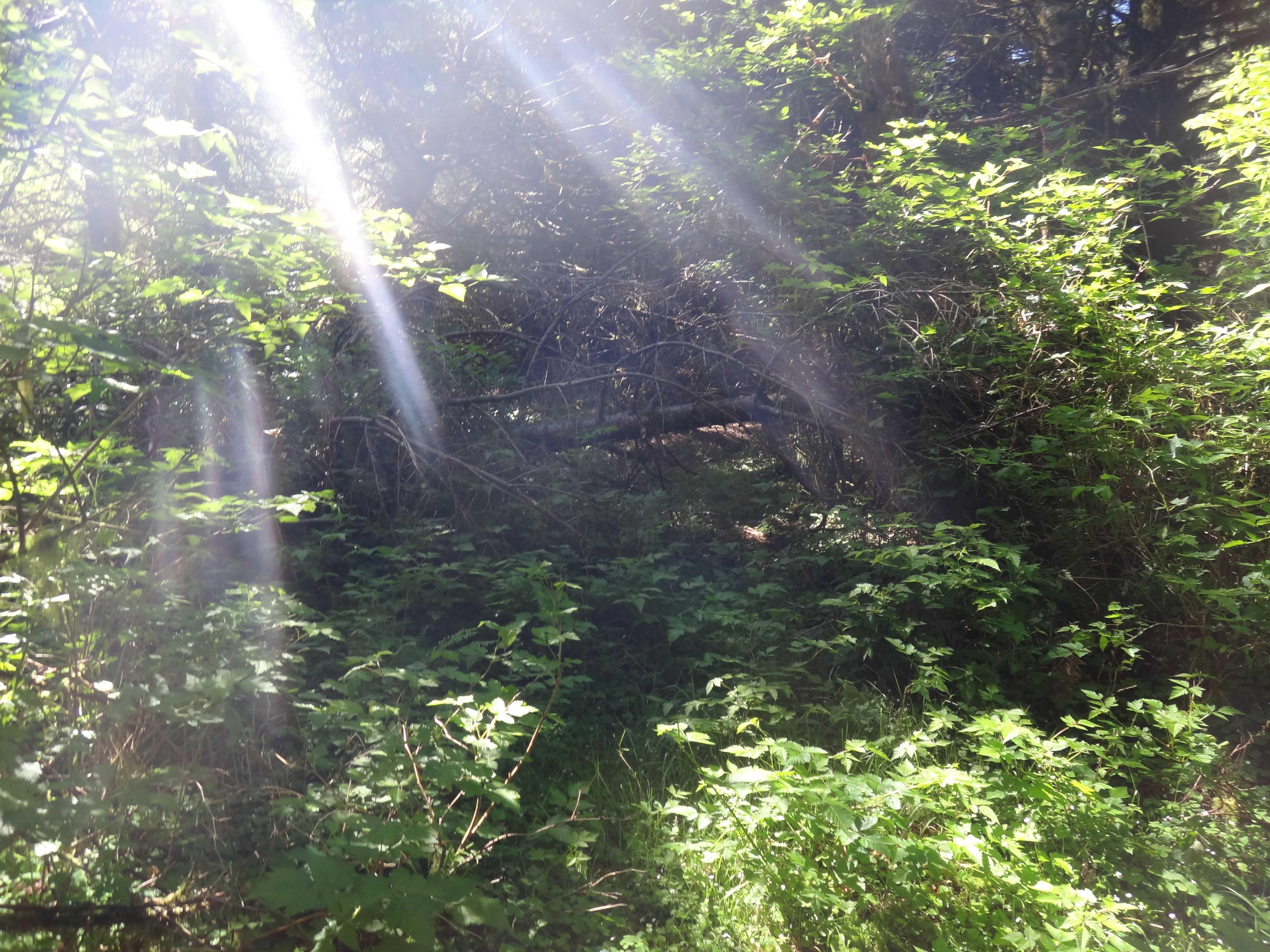
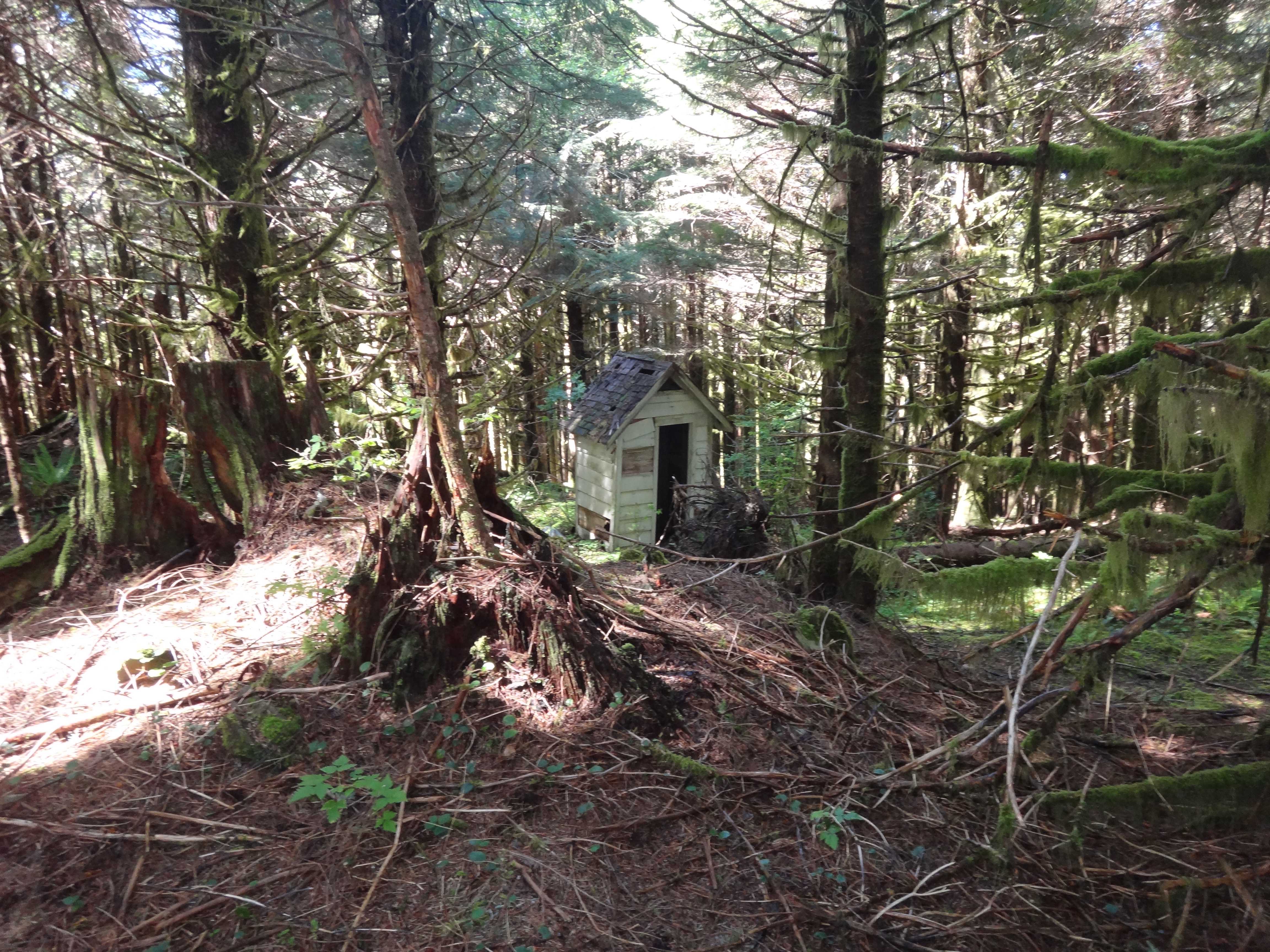
From there use your instinct to achieve higher ground. Eventually the brush will thin out and you will see signs of the old lookout. In particular, the outhouse is still standing.
Nearby is a high spot that is relatively open and comfortable. You will be surrounded by plenty of tall trees from which to hang wire.

Aside from some bushwhacking going up and back down, this was an easy and interesting activation. An alternative route to the activation zone might be from the antenna site across the ridge. I looked for signs of a trial when I was there, but couldn't find anything obvious. Even though the activation zone is almost completely blocked by vegetation, the road on the south face of the ridge offers a splendid view.

(Cross-posted at WW7D's blog)