
Most of the difficulty with these peaks is the drive not the hikes. The road to Lookout Mountain is not bad and can easily be done by itself. But if you are activating 6001 or Badger Butte, might as well go for the hat trick. For a total hike of 5.4 miles with 1400 feet of elevation gain, you get 16 points. Bring a GPS on 6001 and Badger Butte for the bushwhacking.
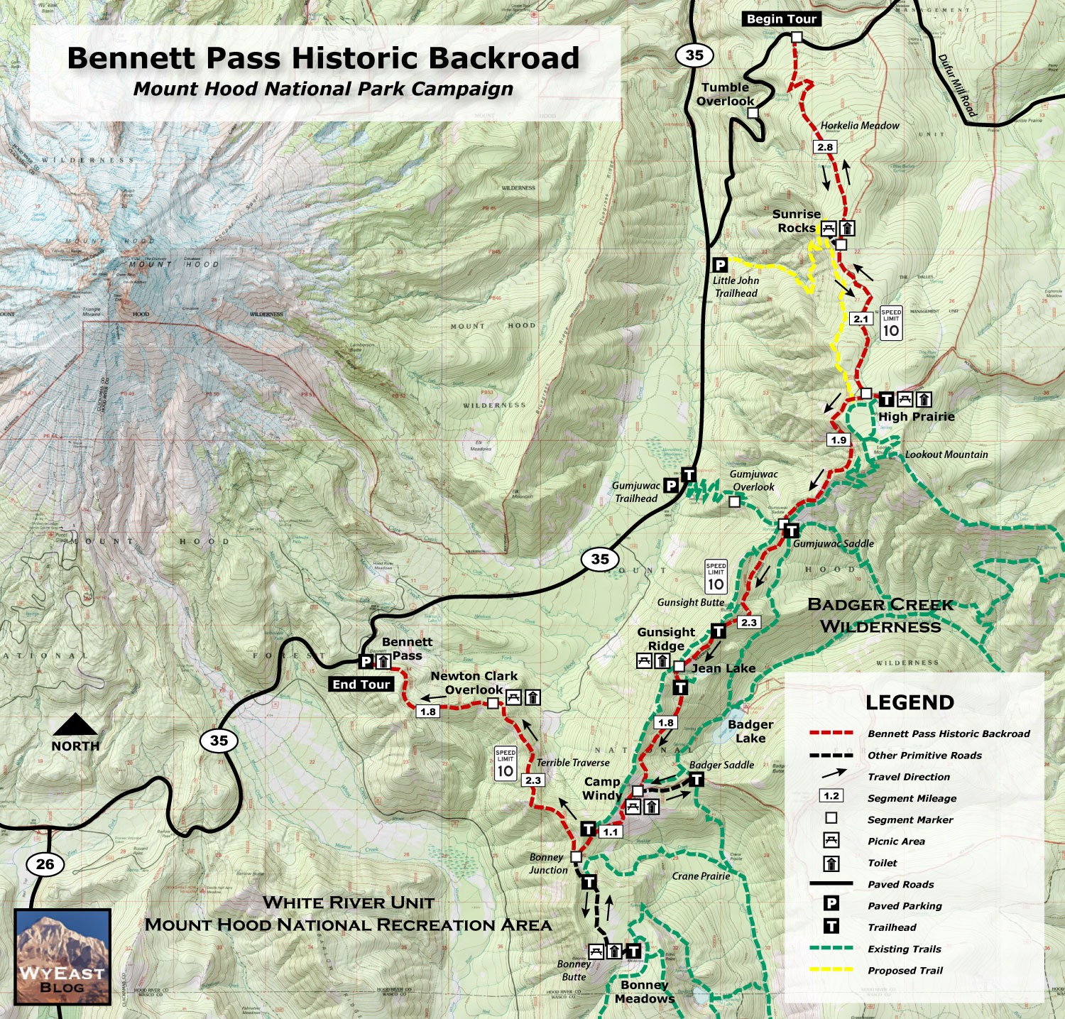
There are some good reports on PNWSota with different places to park. I selected the ones closest to the peaks to shorten the hikes. GPS parking coordinates, hiking distances, and my timeline is listed below for reference. This gives an idea of drive times. My journey started with Lookout Mountain and worked south along Bennett Pass Road. Here is a good map of the road:
http://www.mounthoodnationalpark.org/MHNPArticles/170227BennettPassConceptMap.jpg
I have a mostly stock 4Runner with sliders. It didn’t have any problems, but it was slow going and really rough. I only ran into a few oncoming vehicles and got lucky there was room to pass. Driving our Outback to 6001 would not have been fun, but possible. Taking the Outback to Badger Butte and out through the Terrible Traverse, would have been scary and probably caused damage. It would also have made the day a lot longer.
A VHF only activation for all three peaks might be possible. I wouldn’t count on it unless there is a SOTA party or lots of activity that day. There are plenty of trees and space for HF on these peaks. I packed a FT-891 with a 66’ EFHW since the hikes were short.
Jeff
WX7OR
Depart SW Portland: 6:00
Lookout Mountain:
Park: High Prairie 45.352416, -121.53121
Hike (one-way): 1.4 miles and 600 ft
Start hike: 8:20
Back to vehicle: 10:50
Peak 6001:
Park: 45.31015,-121.57186
Hike (one-way): 0.6 miles and 350 ft
Start hike: 11:20
Back to vehicle: 12:50
Badger Butte:
Park: 45.28654, -121.55080
Hike (one-way): 0.7 miles and 450 ft
Start hike: 13:35
Back to vehicle: 15:10
Arrive SW Portland: 17:45