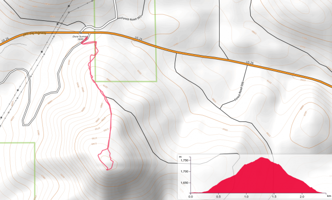
If you find yourself on US-26 at Dixie Summit (the pass), just east of Prairie City, you could activate Dixie Butte, http://www.pnwsota.org/blog/k7atn/2018-november-25/dixie-butte-or-june-2017, with your high clearance vehicle, or you could park your Prius and bushwhack 1.5 miles RT and 550 ft. of elevation gain to 5784.
There is a wide spot on the south side of the road right at the summit. A forest road goes south from there but you can just park. I walked a short distance down this road and turned on an ATV track. This ended quickly at a large downed tree. From here there was a path heading up. It quickly disappeared, but the cross country going was not bad. I was able to skirt the clusters of small trees rather than push through them. The higher I climbed the better the conditions. Eventually, I hit a fence line with a path. That then turned into an ATV track that I believe goes to the top. However, when it started contouring after a bunch of straight up, I headed straight up. There is an ATV track on top, so it is likely the same one. I operated from the exact peak which had a view west. On the way down I followed the ATV track north to the end of the ridge. This had a better view and was still in the AZ. However, if you are looking for trees for antenna support the actual peak serves better.


